These are the locations in Alleghany County that are currently recognized by the National Register of Historic Places.
The National Register is the official list of the Nation’s historic places worthy of preservation. Authorized by the National Historic Preservation Act of 1966, the National Park Service’s National Register of Historic Places is part of a program to coordinate and support efforts to identify and protect America’s historic and archeological resources.
Please notice this disclaimer from the National Park Service:
“Use of these archival materials may be restricted for the following reason: Copyright- Many photographs were taken by individuals other than employees of the National Park Service, therefore there may be copyright restrictions on select images or on articles printed in journals.”
AHGS is presenting this resource for educational uses only. For copyright information please visit: https://www.nps.gov/subjects/nationalregister/national-register-content-and-copyright.htm
The Bays Hash Site in Amelia and the J.C. Gambill Site in the New Haven community are restricted areas of prehistoric significance and do not have data sheets available, online.
Downtown Sparta Historic District
Rock House or the Bowman Gray House
J.C. Gambill Site
(added 1978 – – #78001927) – Also known as All-111;Alv57
New Haven Community
Historic Significance: Information Potential
Area of Significance: Prehistoric
Cultural Affiliation: Native American
Period of Significance: 1650-1699, 1600-1649, 1500-1599, 1499-1000 AD, 1000 AD-999 BC
Historic Function: Agriculture/Subsistence
Historic Sub-function: Agricultural Fields
Current Function: Unknown
Bays Hash Site
(added 1978 – – #78003078) – Also known as All-308
Amelia Community
Area of Significance: Prehistoric
Cultural Affiliation: Native American
Period of Significance: 7000-8999 BC, 5000-6999 BC, 499-0 BC, 499-0 AD, 3000-4999 BC, 1000-500 AD, 1000-2999 BC, 1000 AD-999 BC
Historic Function: Industry/Processing/Extraction

New Historic Site Finding Aid from the Historic Preservation Office
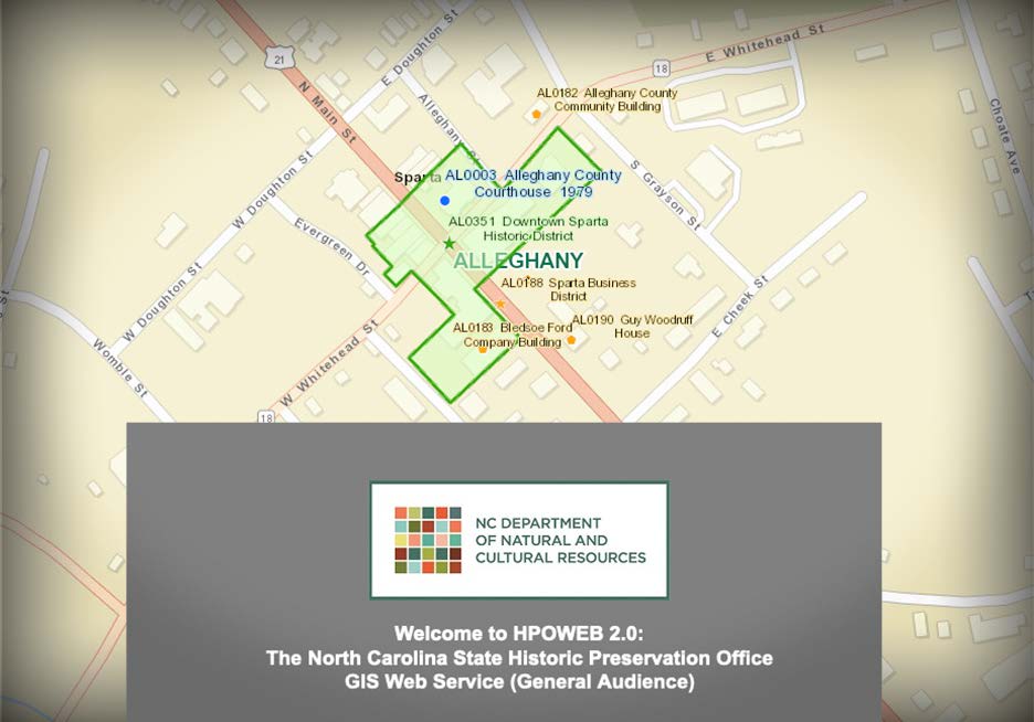
Have you seen this great resource by the North Carolina State Historic Preservation Office? They have created a GIS Web Service, to serve as an aid in planning and research. It is an online map that shows virtually all recognized historic sites in the state. Site locations and boundaries are “drawn from georeferenced scans of National Register and historic property survey maps, supplemented with aerial photography, county tax parcel layers, and other sources.”
When you arrive at the site, click the disclaimer at the bottom of the screen and you can see the location and status of many (many!) historic sites around Alleghany and beyond.


